Showing posts with label bicycling. Show all posts

Thursday, July 25, 2013

How I'm Spending My Summer

A common view for me these last few months
Not since sometime before 1976 have I had a summer like this.

Back in that time, I guess when I was around 12 or so, I inherited my brother's paper route.  From then on I have been working a "job".  On May 15th, I had my retirement ceremony after serving 30 years in the Coast Guard.  Since then, I have been doing things that aren't actually "work", although some of them are "work like".

I don't actually retire until September 1st, so I'm still getting paid.  Thirty years of service give you plenty of time to accumulate lots of vacation time.  We are given 30 days of leave a year.  There were many years when I didn't use all of those days.  Don't get me wrong, I liked taking my leave days, but playing the system right, I was able to take a day less here or there and garner days on the books.  My last twelve years of work also had a nice schedule where I worked an hour longer each day for 9 days and then got the 10th day off.  It worked out well.

The wars we have been involved in have also let me go beyond the usual 60 days on the books cut off, so I had a real nice 88 days or so sitting there waiting for me to take them.  You are also given 20 days of Admin time, so all in all I had about three and a half months of "time".

Yes, you can sell those days back to the government and add some money to the bank account, but I like to use them so much more.  To savor each one.  To go to bed when I feel like it and get up when the urge strikes me.  I still pretty much keep to the same schedule.  Nine o'clock usually sees me heading down stairs to read for awhile before I shut my eyes and 6:30 rarely sees me still in the sack.  I like getting up with (or before) the sun.  I like seeing the day arrive.  Now, I just make a pot of coffee and head to the computer room for some light reading and sometimes some writing and then I start my day.

But getting back to the mid 70's.  Those were the days when I would get up with the day.  No school, no grass to cut (I guess that was a job too), no pressing plans of any kind.  I would get my bike out and take it down the 13 steps of our house and hit the bricks.  Literally hit the bricks.  Irwin Ave. in Bellevue is one of the dwindling streets of the borough that are still as they were back at the turn of the 20th century, brick.

Irwin Ave - Brick Street
So, I would usually head up to Grant School to hang out.  This was a few blocks from the house and I could spend the whole day out there somewhere, hanging out.  Without a care in the world.  And my parents weren't worried either most times.

Later in the day we would maybe play some kickball on the street and when darkness arrived, hide and seek was a pleasant way to spend a summer evening.

We would have passes to Bellevue Pool and when we could get a ride, we would be there for a good portion of the day.  We also had a nice camp up by Moraine State Park where we spent many a week and weekend.  Also, there was always Conneaut.  Ahhhhh, Conneaut.

The day's just seemed to take forever and each one started with the song of robins, cardinals and blue jays and ended with the drone of cicadas and night hawks.  Gosh, I miss the creaky call of the night hawk.

So, the picture I just tried to paint was of a young me, with no worries and little obligation or responsibility, doing what I felt like and having a good time doing it.

These last two months have been somewhat like that.  I still have the adult obligations and responsibilities that most adults have.  Mortgage, bills, college tuition, etc, but my day is less structured than it has been in such a long time.  I lose track of what day it is.

I still have plenty of things to do.  If you have followed this blog or my Facebook 365day entries, you will see that I have been doing some work around the house.  The grass seems to be growing wickedly fast this summer also and today, I will once again whack it back to a reasonable height for the next week and a half or so.

I have also done some travelling.  Not the usual kind, but by foot and bike.  Shortly after my retirement ceremony, my Bride and I headed south, to Virginia, North Carolina and Georgia to do some Appalachian Trail hiking.  Our original plan (to hike two to three weeks straight) lasted about eight hours into the hike.  Lisa suffered a bad twist to her ankle that still is bothering her, but the freedom we had with our schedule left us to change the plan and do something a little different.  Our adventures the first couple weeks of my "vacation" are chronicled here, if you haven't already read them.

At the Arch to the Approach Trail
Fontana Dam
Clingman's Dome
Even though our original plan didn't pan out, we got to see some pretty cool places on the Appalachian Trail and I upped my competed mileage to over 200 miles.

In June I decided to take a little bike ride.  This one was a five day, 350 mile trek from Washington, DC to my Father's house in Bellevue, PA.  I had been hoping to do this ride for quite a few years and getting it done was very rewarding.  I'm still feeling the effects of the damage I did to my ulnar nerves in my hands, but I don't regret taking the trip one bit.  That trip starts here.

Ready to Start
Dam #4
Since then, I have pressure washed and repainted the back deck.  That is the most work-like thing I have done this summer.  It has been very therapeutic, but I'm definetly not as good a painter as my brother.  I had fun doing it, but I'm glad I can say the job is pretty much done.

This summer has also seen me travel up to Pine Grove Furnace, PA a couple times.  It looks like I may have found a job as the next AT Museum Manager.  It doesn't pay much, but it gets me that "in" I have been looking for working with the AT community.  The museum is an amazing place and the AT Museum Society has very big plans for the place and its expansion.  If all goes well, I will be a part of that.

These last two months have also given me the opportunity to grow my beard.  Not something I was doing back in the 70's, but something I have been jonesing to do for awhile.  I like to think that it is coming in nicely.  It was pretty white at first, so I added a little "Just for Men" to knock it down a little and to keep little kids from crawling into my lap and telling me what they wanted for Christmas.  Right now, it is just a toy that I'm playing with, but I think I will keep it a while.  As long as Lisa lets me.  :)

My last day of work
7/23/13
Just a little bit of a transformation.  My hair is starting to cover my ears again.  I can still remember back in 1983, in boot camp, when my ears first saw the light of day since I was about 8 or so.  They burnt, then peeled very nicely.  I don't have as much hair anymore to get back to what I had in the 70's, but it is nice not having to visit the barber for that military taper every couple of weeks.

And so it goes.  My summer continues.  We still have some things to do like spend a week in Cape May and I will continue to travel to Pine Grove Furnace and hike the nearby trails.  I have also planned out a short backpack trip to the wilderness of Dolly Sods in West Virginia.  The honey do list will continue.

It is now time to take Ginger for her morning walk and then I think the pool needs me to check its temperature... With my body...

Monday, July 1, 2013

I Want to Ride My Bicycle - Day 5

Day 5:

After another decent night in the hammock, I was up and out at 7:15am.  I knew today was going to be a long day, but the temperature was very tolerable, in fact I was actually cold for a while until I got riding.

Pretty early in the day, I came across a biker stopped on the trail and looking up across the river.  His name was Chris and he had just flushed an eagle from this side of the river.  It had moved across the water and was waiting for us to leave.  I couldn't get a view of it, but it was cool to know they were in the area.

I continued along the Yough in the morning coolness and before long, I came to Connellsville.  After going through the town, right down Third St, I started out of town and came upon a small park where they had two adirondack shelters with tables a grill and water nearby.  The shelters were a lot like the ones on the AT, but very new.  I checked them out and made a note for any future trips to the area.  Shortly after that, I passed the Rivers Edge Campground.  This is a developed campground, but could also be a resource for a night's stay.

Connellsville Shelter
The day just started to fly by.  It still wasn't too hot and even though it seemed that I was out in the open more, I didn't feel like I was getting baked by the sun.  More campgrounds and small villages passed by as I steadily pedaled to my goal of Bellevue, PA

At Cedar Creek Park, they have some very nice tent pads and good trees for hanging.  In the corner of the park, overlooking the river sat this shelter.  Modelled after the ones I have stayed in on the Laurel Highlands Trail.  It has a nice stone fireplace facing into the shelter.  Very cool.  I rested here and ate lunch on my last day of the trip.

Cedar Creek Shelter
Next I rode through West Newton.  From here into Boston, the trail seemed to get a little bland.  The trail is pretty far from the river and it seemed like I was riding behind a bunch of back yards, out in the open with the sun shining down on me.  One of the interesting places I passed was an old coal mining "company" town by the name of Whitsett.  They had an old picture from back in the early 1900s and you could still make out the same houses with their identical double chimneys off in the distance.  

Another place I stopped was some very fresh picnic tables and one of those pre-fab cabins with a bunch of bikes, kayaks and stand up paddle boards sitting outside.  I talked to the guy there and they were a new venture that had just started up.  The owner of the land had plans to make the area into a park.  It seemed pretty nice and would be a great place to work.  

I could tell I was getting close to the Burgh when I started seeing stores names like the one below.

Scoops N'at  
I had seen a couple other snakes on my trip, but I stopped and came around to get a picture of this guy sunning himself on the trail.  Not the best location to pick, but very visible for all passersby.

Black Snake
 When I got to Boston, I was resting and reading a sign that showed two possible routes into McKeesport.  I had my iPod on, which I had started using in the afternoons to help me motivate myself to keep going and I heard someone ask me which was I was heading.  When I figured out where the person was addressing me, I saw David, a trail volunteer and we had a nice conversation as I refilled my water bottles.  He asked for some help if I had the time as I was about the youngest person in the area.  He needed help moving some picnic tables so he could cut the grass.  It was a nice diversion from the constant pedaling and I quickly agreed to help.  It was an easy task and before long, I was back on the trail, taking the alternate route that David recommended that would bypass some of the road riding, avoid a hill and give me more paved trail.


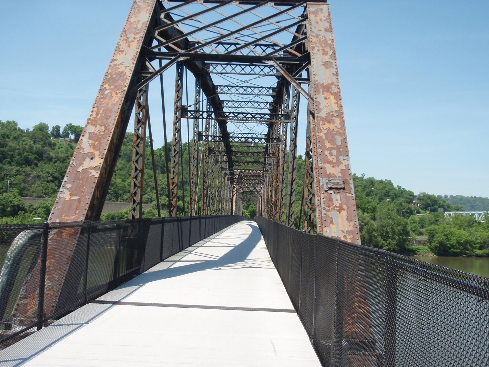
 As I moved along the edge of McKeesport I was eventually led to this 100 year old railroad bridge.  I was now on the Steel Valley Trail which had become a part of the GAP.


I crossed the Monongahela River on this old bridge and continued along the South Side.   

Mon River
I passed through Duquesne and into Homestead.  The trail runs along the active tracks and every once in awhile would go up to a footbridge and pass over the tracks.  I passed the Pump House where one of the bloodiest battles of the labor/management conflicts between the steel workers and Andrew Carnegie occurred. The 1892  tussle was called The Battle of Homestead and was between thousands of workers, their families and supporters armed with sticks, rocks and guns against 300 Pinkerton Men hired by Carnegie.  Ten people were killed and the PA Governor sent in Militiamen at Henry Frick's (Carnegie's partner)  request .

Shortly after the Pump House is this interesting labyrinth.  I took a nice break here under the shade of one small tree and enjoyed the view.

Labyrinth
Soon I passed the old Homestead Steel Works, which is now a shopping center with a big movie theater.  One of Lisa and my Adventure Races had us getting information off the stacks as a control point a few years ago.
Before long I was passing through Sandcastle the brand new last part of the trail.  This amusement park had been a stopping point in the trail for quite a few years.  The original owners had finally sold the park and the new owners were much more agreeable in making the deal that enabled the trail to continue all the way to the  Point.

After Sandcastle the GAP now incorporates the Three Rivers Heritage Trail.  This is the trail that I would basically follow into the Northside and home.

I took another rest outside the Steelers South Side Training Facility.  I always like checking this place out.


From there I crossed the Mon again on the Hot Metal Bridge and was now following the Parkway East for a while.  At one point I was actually moving faster than the traffic as it was now around 4:00pm and rush hour had started.
Cathedral of Learning

First view of the city buildings
 I stopped at a Golden Triangle Bike Rental shop that was another stop on our Adventure Race and talked to a girl working there as I stood under the mist spray and refilled my water bottle for the last time.

From there I just followed some green signs to the Point as I rode the streets of Pittsburgh.  A couple out on a bike ride started following me because I guess I looked like I knew where I was going, but after warning them that I wasn't an expert, we all saw the fountain and homed in.

I took a couple pictures of Heinz Field and the Fountain and then headed across the Ft Duquesne Bridge to the North Shore.
STEELERS!

The Fountain at The Point
From there I followed the Ohio River on the Three Rivers Heritage Trail by the Stadium, the Science Center and the Casino and into the North Side.

When I came to the Penitentiary, I hit the streets and headed up to California Ave.  It was quite a climb and I had done it before, but with all the weight I was carrying I didn't even try to ride it.  The walk was a nice pace change and I was so close to my goal, I could taste it.

Once I got to California Ave, it was just a few short blocks until I was crossing the Bellevue High Bridge and was entering the Borough I had grown up in.  I literally hit the bricks of the Bellevue streets and pulled up in front of 199 Irwin Ave at 5:45pm on the fifth day of my trip.  I had accomplished my goal of riding "Home" from Washington, DC.

I walked into my house and my Dad wasn't even surprised to see me.  Others who had been following my progress had informed him of my quest.

I was home...

My bike computer said I had done 83.5 miles in 7 hours and 52 minutes of riding time and a total travel time of 10 hours and 30 minutes.  The computer also had a grand total mileage of 351.5 miles.

Other math says the 184.5 mile C&O + the 150 mile GAP + the two extra miles I did in DC + the 5.8 miles from the Point to my house. My total trip was somewhere around 342.3 Miles.  My side trips in towns and at Ft Frederick would knock that up a little more, so I'm good with saying it was a nice 350 mile trip.

Tomorrow: Five Days in Pittsburgh (and Conneaut and Bruin) Where I went for a record number of days eating burgers off the grill.

Sunday, June 30, 2013

I Want to Ride My Bicycle - Day 4

Day 4:

The C & O Canal Trail was done.  It was now time to tackle the Greater Allegheny Passage (GAP) and the beginning of it would be the hardest.

I was up and out of the hotel at 7ish.  I hit the nearby McDonalds for a quick breakfast sandwich and went down the streets to the bike shop and mile zero of the GAP.

Mile Zero
I lubed up the chain and other mechanics and hit the trail at 7:25am.  The plan for the day was to get this uphill out of the way, then have lunch in Meyersdale and then make Confluence to camp at the outflow campsite.  This would once again be a little over 60 miles, so I thought a little about maybe pressing on to Ohiopyle at 72 miles.  We would see how the day went.

Now the trail guides make mention of the grade the first 23 miles of the GAP and say it isn't too bad, and looking back, it really wasn't too terrible.  It was just slow and the day was going to be hot.  I just pushed along as people flew past me going down grade and passed a couple leisurely bikers on my way up to Savage Tunnel and then the Eastern Continental Divide. I would also be entering PA today.

As I made my way up the trail I came to Brush Tunnel.  At 914' long, I figured this wasn't a big deal, so I didn't rig any lights.  Besides it was paved and I could see the exit clearly.  It was a really weird feeling as the light from the entrance faded and I found myself in the pitch black middle.  I could feel myself moving, but had no other sensory input other than seeing the exit getting larger in small increments.  It was quite an experience and I'm thankful it was a totally smooth surface as I rode through.  I'm sure one bump would have sent me careening into the wall.

Exit to Borden Tunnel
Eventually I reached Frostburg, MD.  The trailhead was quite nice.  There was actually some little electronic kiosk thing that you could look up lodging, food, camping information for the nearby towns and print out the info.  Pretty cool.  I walked up a needless switchback to get some water at the top of the hill where a campground was.  It was still pretty early and no one was stirring in the area, but I found a bike wash station and filled up my liter bottle and walked down the road which went straight to the trailhead.  Much easier.

I continued on, climbing as I went.  Just going steady and not worrying about how much time it was taking to get the first 23 miles done.  I would stop when I felt like it and take a short break.  I would also stop at every information board I would see, just to rest and also to read the interesting facts about the area.

Looking into PA from MD
One of the places I stopped was Bone Cave.  This cave was discovered in 1912 when they were putting in the railroad and it contained a whole bunch of bones from prehistoric and extinct animals.  It seemed pretty interesting, but as you can see, wasn't something that was open to the public.

Bone Cave
When I came to the next tunnel, the Borden Tunnel which was 957' long, I took the time to rig my lights.  It was a little less disorienting, but still a little spooky in the middle of the tunnel.  I'm really glad they took the time to pave the surface though.

I was about 20 miles in and it was time to leave Maryland.  I crossed the Mason-Dixon Line and took a little break, ate a snack and then moved on.

Mason-Dixon Line
 Shortly after that is Savage Tunnel.  This is a pretty long one at 3294', but it has lights.  Well, mostly has lights.  It is closed in the winter to avoid deterioration that the railroad had to deal with over the years, but was wide open today.  Every once and awhile a light would be out and the darkness would gather around your for a few seconds until the next light's glow would help you along.  It was a nice ride and was pretty cool inside.  I pleasant relief from the hot day.

Savage Tunnel Entrance
 After the tunnel, you round a bend and you can see it.  The Eastern Continental Divide.  Your uphill battle is almost done.  I got to the tunnel that marks the divide and stopped to take a break.  There was a family of three out for a day ride and we had a nice conversation about our rides.  From there I started down hill.

Eastern Continental Divide
 I noticed right away that the going was easier.  My speed crept up to a high for the day.  I was able to keep a constant 13 to 15 mph as I moved along.  It had taken me almost four hours to climb that 23 miles, but I was moving now.

As I was riding along, a guy came up on me from behind.  I thought he was going to buzz on past and leave me behind, but he matched my speed and we started a nice conversation.  It turns out his name was Steve and he said he was one of the people responsible for the trail.  He said he is friends with Mary Shaw and Roy Weil, two very active supporters of the trail and told a lot of how the trail was made as we sped along towards Meyersdale, PA, my lunch stop for the day.

Before I knew it, we were crossing the road that marked Meyersdale.  After doing 23 miles in almost four hours, I had just done another 10 in 40 minutes.  I liked going "down hill".  Steve told me that a Sheetz was just down the hill, so I single mindedly just started down instead of looking around.  It was quite a downhill, that I had to walk back up.  If I would have stopped at the refurbished train station/visitor center for a bit, I would have seen that everything I needed was within a few hundred feet of the trail, but it wasn't a big deal.

After my lunch, I moved on down the trail.  At Rockwood, I picked up the Casselman River and started following along.  Every so often a spring or stream would come cascading down the hillside to meet the river.  This was a pretty cool waterfall that was right next to the trail.

Cascade
 Also, as I approached Rockwood, I passed the Husky Haven Campground.  It was right next to the trail and each campsite had a little A-Frame to keep wood in, which was provided.  It seemed like a nice place to stop on another trip, but not today.  Onward I rolled.
After Rockwood, I came to the Pinkerton Tunnel, which was closed.  Instead the trail followed the river around the hillside and back again.  There was something weird going on on the hillside.  It kinda looked like a landfill or maybe a strip mine reclamation.

I arrived in Confluence before 4pm and knew I was good to go another 10 miles.  I filled up on water and kept riding down stream, but now I was following the Youghiogheny River and would follow it all the way to Pittsburgh.

I arrived in Ohiopyle and stopped at an information booth.  There was an older gent on a recumbent bike also taking a break.  We talked a while and discussed the merits of the strange bike he rode.  I'm sure my ass and hands would be feeling  a might different if I had one of those, even though they look weird.

Onward I continued across the river twice as it does a horseshoe bend around the town.  I eventually came to a sign point up a path to the campground.  And I do mean up.  I had to climb the ridge along this path.  I saw two others start up just ahead of me and we walked up together pushing our heavy bikes.  They were part of a boy scout group that had biked here a couple days, were going to raft tomorrow and then bike back to their starting point outside Pittsburgh.  They proudly stated that they had ridden 40 miles today and looked at me like I was either crazy or lying when I said I had done 72.

Eventually we got to the top of the trail.  After talking to their road support guy, I found I had to continue on to the contact station and register for a site.  It wasn't as bad as the path and I eventually got there paid my resident fee (using my Dad's address) and ordered some firewood to be delivered by the Camp Host.

I checked out the site and found two suitable trees to hang my hammock and was all settled in and headed to the shower by about 6:30pm.  I had a nice dinner, a nice fire and hit the hammock just as the woods were getting dark.

Hammock set up

Campfire
It had been a tough, but productive day as my bike computer said I had gone 77.25 miles. (It is never quite right, even though I it set up as per the directions.  I know I didn't ride that much more than the posted mileage).  I was at milepost 72 and had chalked up 7 hours 56 minutes of ride time and a total of 9 hours and 35 minutes travel time for the day.  I had about 78 miles to go to hit The Point and then a few more after that to reach the home of my childhood.  I was riding home...

Saturday, June 29, 2013

I Want to Ride My Bicycle - Day 3

Day 3:
After a decent nights sleep I was up somewhere around 6am.  After answering numerous questions from Hayden, I hit the trail at 7:09am.

This day seemed to go pretty easy.  I started off continuing my ride along the Western Maryland Rail Trail until its end around MM 136 or so and transferred back to the C & O for the rest of the day.  This was the final stretch.  Today's goal was just around 60 miles to the end of the C & O and the beginning of the Greater Allegheny Passage or GAP.  Cumberland was this point of the trail.  Cumberland as a city was established in 1787, but has been a place of gathering and living for thousands of years.  The confluence of Wills Creek and the Potomac River has had people there for quite some time.

The day had me in the zone of riding.  My butt wasn't giving me much trouble, but now my hands needed the breaks.  I kept a decent pace throughout the day and all was falling into place.  Of course, thunderstorms were once again predicted for the day, but I had been lucky so far.  Maybe today was the day to be dumped on.

I used the practice of stopping at each hiker/biker camp and drinking my water and then filling up, taking a little break each time.  This seemed to keep me hydrated and rested enough to keep a decent pace and get some miles under my tires.  I would also take a break when I passed something interesting, like one of the old locks.

Lock
Now that I was paralleling Route 68 and in the more remote part of Maryland, I noticed a lot more wildlife on and next to the trail.  The deer would hang out on the trail and when they would see me coming they would just stand there and stare for a while until the realize I'm headed right for them.  Then they would scurry off the trail and hide in the bushes until I passed.  The rabbits and squirrels were in a great abundance too.  Chipmunks not so much, but they made their presence as well.

Once again during this trip a Pileated Woodpecker flew right over me.  They are some big birds and their laughing call echoed through the woods as I rode along.

The highlight (or darklight) of the day was going through Paw Paw Tunnel.  This tunnel was around MM 155 and is the only tunnel on the canal.  This tunnel is 3118 feet long with no lights, a small path to walk on and nothing but a wooden railing to keep you from falling into the canal on your right.  They started building it in 1836 and didn't finish until 1850.  The venture bankrupt the developer of the project, but when it was done, it saved six miles of horseshoe bends along the Potomac.  It was quite an experience going through the tunnel.  I could feel the cold air flowing down the hill from the tunnel as I approached.  I readied my lights and entered the tunnel.  I hadn't gone more than 50 feet before I realized I would be walking for a while.  The path was pretty uneven with lots of water and the darkness was complete.  Kinda like Gollum's cave.


After a while I noticed the path had smoothed out, so I remounted and slowly made my way to the small opening at the other end that didn't seem to be getting bigger.  Within a few minutes, I saw some headlamps heading my way.  I passed three riders heading east and we exchanged greetings and information about the rest of our dark passage.  It was pretty cool, but felt good getting back into the light.

Looking to the end. Still a long way to go
Looking back to the beginning
After the tunnel and a few more miles down the path was where I stopped for lunch at Potomac Forks Lock House.  It was a pleasant area with a hiker/biker camp across the canal.  All in all the day just seemed to fly by.  Just  before stopping for lunch, I came on a group of four riders taking a break.  One asked me how far I was going.  When I replied, Pittsburgh, they said they were heading there too.  As I sat and consumed my peanut butter and jelly burrito, the group rode by.  I noticed at this time that they were a party of five, not four.  One of the girls had a small dog in a basket on her bike.

Potomac Forks Lock House
As I rode along, the sky began to darken.  It looked like today was the day to get rained on.  A few sprinkles came and went and after a while a steady drizzle began to fall.  I had no need to don any rain gear, as the temperature was pleasant and the rain felt good mixing with my sweat.  I noticed that I passed the group taking a break.  Shortly after that, I stopped to eat a snickers bar and along came the group.  

I was feeling good and decided to catch them and ride along with them for a while.  They kept a fast pace, but the trail was nice here and it was easy to keep up and eventually pass them.  Racing to Cumberland to see who would finish the C & O first.  (only in my head, no official challenge was made).

As I talked to the girl with the dog, the little terrier would just look at me, like WTF are you doing there.  She was cute and I think her name was Ava or something like that.  The group were from Ohio and were doing the whole trail to Pittsburgh.  As we talked I learned they were heading to Cumberland today and then taking a shuttle up to Frostburg, MD thus avoiding the steepest part of the trail as they were behind schedule.  It is 16 miles to Frostburg at an average of 2% grade.  That might not seem like a lot, but after doing a 1% grade for 184 miles, you do notice it.  The steep grade continues for a total of about 23 miles up to the Eastern Continental Divide.  I would be pedaling the whole thing in the morning, but from there it would all be "Down Hill".

Young Snapper
Some interesting hills near town
The rain slackened and then quit as I made my way into Cumberland.  The area turned to fields and other signs of civilization and you could tell you were nearing a city.  

Before I knew it, I was crossing an old railroad bridge and had completed the 184.5 miles of the C & O Canal Trail.  There was a bike store right at the trails called the Cumberland Trail Connection.  I went in and bought some lube for my chain and other mechanics.  Then I headed up the street to the Holiday Inn.

End of one trail, the beginning of another
I had decided to celebrate the end of the C & O with a hotel stay and since the skies were still threatening, I deemed it a good idea.

I checked in and was able to use my military discount to knock off quite a few bucks on the price, took a shower and did some sink laundry.  The water turned pretty gray, but I think that was mostly from my gloves where I had rubbed in some oil off my fingers after fixing my occasional chain popoffs.  

Sink Laundry
My digs for the night
After a short nap, I went out to explore the town, eat some pizza and check out the bike store again.  It was now around 7pm and the shop was closing.  I got some crab dip and a beer at the Crabby Pig near the river and as I finished up, it started sprinkling again.  I made my way back up the three blocks or so to the hotel and just started getting pretty wet as I entered the lobby.  

A cool statue by the train station
Interesting sight.  Four church steeples in one view
What I avoided
The day was a fast one.  My earliest start at 7:09am and my earliest finish at 2:16pm.  My bike computer said 60 miles with a ride time of 5 hours and 48 minutes.  Total travel time was 7 hours and 7 minutes.

The C & O Canal Trail, 184.5 miles done, about 150 miles to go on the GAP.  Tomorrow I started on the GAP and the steepest ascent of the trail.


Friday, June 28, 2013

I Want to Ride My Bicycle - Day 2

The night was spent pleasantly enough.  If you like leg cramps that radiate through every muscle and tendon of your legs, that is.  The mixture of riding 66 plus miles and a little bit of dehydration made my body complain a bit as I tossed and turned in my hammock throughout the night.  No rain fell at all and that was good.

I was up around 5am or so and on the trail at 6:17 after a quick breakfast of an oatmeal bar.  I got some water at an NPS campground down the trail and made use of their privy.  I wasn't moving too fast that first hour, but after a while my speed increased and all was going fine.

My first goal was Williamsport for lunch.  My guide said a Sheetz was there and I love picking up food at Sheetz.  It usually isn't too cheap, but I liked the convenience.

I took a quick break at Dam #4.  There used to be a road detour here as the tow path ran along the river after this dam and it had eroded away from the river action.  Near this point, the barges would move into the river and be towed up stream for a while before going back to the canal.  They were able to do this as the dam created a nice Slackwater section.  In fact, it was called the Big Slackwater.  They had recently repaired the towpath with nice smooth cement sections and I continued along the river for a few miles.

Day 2 - Me at Dam #4
I made it to Williamsport right around noon and headed up the street to the Sheetz.  I was pretty hungry by then, so I went a little crazy getting my meal.  Of course, a Monster drink was an integral part of the meal.  Love that Moca Loca.

As I was headed out, I saw two other bikers fiddling with their bike.  I went over to say hi and saw they were fixing a flat.  I learned they were from Cleveland, so after some good natured back-and-forth about our football teams before I headed back to the trail.

One hour later, I was riding along and all of a sudden, boom, hissssssss.  I get a flat.  I couldn't tell what I had hit, but it didn't really matter at this point.  I put one of my spare tubes in and used the CO2 cartridges to  fill it back up and I was moving again in about 20 minutes.  I think it was at this point that I realized 60 miles was about it for me at this stage of my journey and conveniently, Hancock, MD was right about at that point.  I made that my goal for the day and decided that I wasn't in a real hurry to get there as we were nearing the Solstice and I had plenty of daylight.  

I took breaks often and would stop and take a picture of anything I saw interesting.  

An old mill
Second Box Turtle I saw
As the afternoon wore on, I came upon a sign for Ft Frederick.  I headed up the hill and saw an amazing sight.  A completely stone fort.  Of course I was in such awe, I forgot to take a picture of the outside, but after getting some water and cooling off with the fountain for a bit, I left my bike under a tree and headed to the fort.  There was a worker in period costume inside and once we got out of the sun, he told me a little about the fort.  It was built during the French and Indian War in the 1750s, had never been attacked because of its awesomeness and had been used in each war after that.  There were two buildings inside the fort and they were made up real nice in period scenes.  I took a bunch of pictures of these rooms as I leisurely walked around the place in the 80 degree heat.  Here is one of them.

Officer's Quarters - Ft Frederick
After my "tour", I headed to the visitor center store and bought an ice cream sandwich (this would become a theme) and picked up a map.

The map was of the Western Maryland Rail Trail, which started nearby and went for about 20 miles to and past Hancock.  I was ready to get off the gravel for a while and this nice path was paved.  It ran pretty near Rt 70 for a time, but was still pleasantly covered in shade for most of it.  

I found the trail and started along it.  Before too long I was in Hancock, MD.  It was 4:30 pm.  Both trails run right along the edge of Hancock.  My destination today was a Bunkhouse that was behind the local Bike shop, right off the trail.  Also, there was a Sheetz in town.  

The bike shop was nice and the bunkhouse only cost $10.  I bought some replacement CO2 cartridges and a seat pad for my still hurting butt.  It was getting better, but still uncomfortable.  I had developed a technique where I would stand on the pedals and pedal every couple seconds or so.  It seemed to keep my speed up no problem and gave my arse a break.

The bunkhouse was in the "backyard" of the shop.  I headed back and picked a bunk.  There were some rudimentary showers out there, two privies, a fire ring and an outside area to hang out.  The bunkhouse was basically a long three sided shelter with a screened in front.  The bunks were plywood with cheap Walmart sleeping pads on them.  It would suffice for the night.
The Bunkhouse

My bunk for the night
There was already three people in residence, but they were out when I arrived.  It turned out to be a couple, Jim and Maria and their grandson Hayden.  They were from the Eastern Shore of Maryland and were out to show Hayden what a longer ride was like.  They planned to ride to Little Orleans, about 15 miles to the West and back, making a 30 mile trip.  Hayden was interested in everything and had lots of questions.

Later in the day, Guru and his son Shawn came in.  They were from Squirrel Hill, PA and were also headed East to West, but Guru had some knee issues and they were calling it quits at Hancock.  His wife would be driving from Pittsburgh the next day and picking them up.  It would have been nice to travel with them, so I was sorry to see their trip end.  I forget Guru's real name, but that was his trail name.  He had started a Thru Hike of the AT in March and had made it to the NOC about 137 miles in before he was knocked off the trail with giardia.  

We had a nice fire in the firepit and talked way past biker midnight.  I slept ok on the plywood with my own pad adding to the blue pad, but still had to change positions every once in awhile as that part of my body numbed up.
Camp Fire
Also, when I was taking a shower, I noticed that my ring and pinky fingers were numb.  I had remembered reading about that and how it was common when using straight handlebars and doing long rides.  I made a note to do some research when I had  a chance to address the all knowing Google.  

The bike computer registered 63.3 miles for the day in 6 hours 45 minutes of ride time.  My travel time was 10 hours and 13 minutes and I was at mile marker 124 of the C & O. 

Only about 226 miles to go...