Wednesday, August 26, 2015

Class of 2015 - Update

Time for another update on our six hikers.

Slingshot has completed his hike.  Congrats Slingshot!  Andrew summited on August 3rd.  He reportedly climbed the Big K in two hours.  Yes, two hours.  Amazing.  It looks like his hike took somewhere around 146 days. Very Impressive.

Although the Hairy Missile couldn't finish the last few miles with SS, he is just as much a Thru Hiker and anyone else.  Great Job you two.  


Andrew is now reintegrating himself with the World again and doing things like windsurfing and preparing paleo meals for Hannah.

Hannah on the board

Clifford was not too far behind and summited on August 11th I think.  162 days.  Also a very impressive time, especially when you look at the things he did like graduate from HS, visit his college and other visits to home.  Great job Sam.

Nice tie, always classy
Since his summit, Sam had moved into his dorm at University of Virginia.  Good luck on your next adventure Sam.

Move in day at UVA

Treehugger did make another attempt to get back on the trail in New England to try to at least get to Mt Katahdin, but her knees rebelled once again and she had to admit that this hike was at an end, for now...  

Kerry had her amazing picture at the Flip Flop Kick Off printed in the Summer AT Journeys magazine, which is pretty cool.  Kerry completed about 700 miles of the AT.  Not too shabby.


Scoops and Iceberg completed their latest sojourn into NJ and NY and are most likely planning their next visit to the AT.  

Scoops enjoys some trail magic
Justin is moving through Maine and appears to be "doin it right".  He somehow finds the time to do things like take a plane ride and go white water rafting, but he continues to move south towards New Hampshire.

The beginning...
His last update shows him at Mt Bigelow.  But in the mean time, there is always time for this.

Livin the life
Keep on hiking Hiker...

EarthTone

Friday, July 31, 2015

Long Awaited Class of 2015 Hiker Update


I have been holding off on doing another update until a certain southbounder has started his hike.  That time has come.  

But first:

Slingshot has moved ahead of Clifford and will finish VERY SOON!  Hannah's last update put Andrew on top of White Cap Mountain which is somewhere around 70 miles to Mt Katahdin.  She will be meeting him up there to take custody of The Hairy Missile and be there to celebrate with him afterwards.  His date with the Big K is August 3rd.  Great job Slingshot!

Clifford is not too far behind.  I think he is milking the last of his hike, because "real" life is waiting, but college doesn't start until late in the month, so why hurry.  

Clifford's last update had him improvising a shelter in the wilderness after coming a little short on a 24 mile day attempt.  Not a big deal for an Eagle Scout.  

Shelter?
On Tuesday I got a message from Deb, saying Clifford had left Rangeley, ME.  That left him with about 220 miles left to go.  

Treehugger is still at home.  Her knees have rebelled and she had to come off trail again and do some PT.  She has weened herself off of vitamin I and is planning on coming back to the trail up in Mass where she got off after taking her daughter to college and continuing north.  This trail isn't done with her yet.  There are still so many trees to hug.

Scoops and Iceberg are back on the trail.  They are calling this Phase III.  Phase II was in early July when they were waiting to close on her new house.  They headed to near the WV/VA line and hiked north to PenMar, the PA/MD border.  

So, today, they started Phase III.  They will take about 8 or 9 days, so they are starting at Delaware Water Gap and hope to knock off the state of New Jersey.  

Even though their hike is no longer a Thru, no one cares out there.  Hikers are hikers.  We all smell the same after a few days on the trail.  I can tell the bug has gotten a hold of them, just as it has for me.  The trail is now in their blood and it will Never let go.  

Their plan now is to see her son off to school in Louisiana and get back on the trail for as long as their bodies and money last.  Keep on hiking Scoops and Iceberg.

And Finally...


This is all you need to see about Justin...


Keep on Hiking, Hikers!

EarthTone

Friday, June 19, 2015

Class of 2015 - Update


It's that time again.

Sling Shot is now the leader of the pack.  Each is doing their own thing and (I hope) enjoying their hike.  This isn't a race and I'm happy to see that each of the hikers are taking the time (and the zeros) to visit with the special people in their life.  

Clifford:  Just moved into New York.  A thunder storm took out his phone a while back, so his updates became sporadic for a while.  

Five more states to enter
Sling Shot:  Is in Kent, CT.  He had his last visit with Hannah last weekend and is now just putting the miles under his feet.  Aramis is still having fun too. 

Tired Dog or Dog Tired
Treehugger: Has gotten as far as Stormville, NY, but was off trail at last check to attend her daughters High School Graduation and to get her knee checked for progress.  Her Merry Band of Flip Floppers is starting to fracture as all groups will do on the trail.  Some got off, others have things to attend to and others hike on.  It is all part of the experience.  

Scoops and Iceberg:  Still off trail.  Life continues to keep them in Delaware, but they still have hopes and plans to return to the trail.  Here is our exchange on Iceberg's facebook page when I inquired about their plans:

Me: So, How are things going with the house?  Is the trail still calling?

Iceberg: Well Joe, that's a loaded question. The trail is definitely still calling but at this point I'm wondering if its time to give up hope to thru. The house is still not finished but is getting closer to the point where we could leave and finish later with (most) basic services in working order for my kids living there. A cortisone shot to my shoulder last week helped a lot, but not completely (although it did wonders for my knees which were STILL barking) so I have an MRI scheduled for this week. Then, a few days ago Scoops dropped a chunk of concrete on his foot which is now bruised and tender. I am beginning to wonder if all these obstacles are being placed for a reason because OMG enough already! Sadly we've lost most of our trail conditioning so physically we'll be starting from scratch again. But I'm still hopeful we can get back ... but the question remains WHEN?

MeThanks for the update. There are many ways to hike the trail. A Thru is NOT the only way to hike the trail.  If you can, get out for a month or so or even a few weeks. The trail will always be here. Take care and keep on dreaming of getting back to the trail.


Justin:  This will be the last picture of Justin on this site of him not hiking.  His start day approaches.  Justin was able to attend Clifford's graduation late last month.  Soon he will be hiking.  
Clifford and Justin


Saturday, May 23, 2015

Class of 2015 - Another Quick Update


Now that I finally finished my write up of my hike, it is time to see where my AT Hikers are along the trail.

Cifford - Has left Harpers Ferry.  He was #205 NoBo according to his picture.  Being near his home these last couple of weeks has offered some good magic, including taking some hikers home for food, etc.


VA is done.
Sling Shot - SS's last update had him near Front Royal.  He rented a car and surprised his girl Hannah at work.  Also taking advantage of being close to home for now.


Somewhere in the Shennies
Treehugger - TH is moving through PA.  Her last update put her near Port Clinton.  Her daughter, Grasshopper, is hiking with her for a while.  


Treehugger's Flip Flop Bubble @ Pine Grove Furnace
I had to take this pic about 10 times with everyone's phone/camera
Scoops and Ice Berg - Still taking care of "real world" business in Delaware.


At the FFKO
L-R, Justin, Treehugger, Scoops, Ice Berg
Justin - Is practicing putting up his tent.  Now try it in the rain, while being soaking wet and cold.  July will be here soon.  :)


I thought it so cool, that we were able to bring four of the six together at the FFKO.  The other two were busy hiking.  

Keep on Hiking, Hikers!

EarthTone

Laurel Highlands Hiking Trail - A Thru Hike (Day 6)

LHHT Day 6
1. Date: 5/8/15
2. Day 6
3. Morning temp: 60. Later 81
4. Weather: Cool in am with some clouds, then sunny.
5. Time start: 0705
6. Time stop and miles: 1035. 6.1 Miles
7. End point: Ohiopyle - End of trail.
8. Events: Grouse drumming, 1 slip on down hill
Log: Last day. It was a very nice morning and we were ready to finish. We headed out together, but I had some issues with the gps app and got behind. There were two decent climbs, followed by two steep declines, but before we knew it we were back at Ohiopyle, where we had caught our shuttle six days ago. It was a great hike.


It was another clear, cool morning and the final day of our hike.  We arose at 6 and got ready for the day.  Today's hike would be the shortest day of the week at only a little over six miles.  There were two 600 foot climbs each quickly followed with a 600 foot down hill.

We actually headed out at the same time today, both ready to get on the trail.  This whole hike I had been running the app Map My Hike during the whole hike in the attempt to get a gps track of the whole trail.  So far, it had worked very well and I had decent tracks of all five days so far.  I had also been taking gps tagged pictures of certain landmarks, like road crossings, streams and power lines.  I had also photographed all the mile stones (except 62, don't know how I missed it) and I had acquired a good deal of data on the trail.  I had also figured out that the best maps are the old topos at the back of the old Laurel Highlands Trail guide.  It was easy to figure out where I was with a glance at the little maps.  Today, my app wouldn't start tracking, so KJ moved on as I fiddled with my phone.  Eventually I just fired up a backup app that would gather the data I needed for the day, but the lady in my phone wouldn't be announcing milestones as the day wore on.  

There be Dragons
Once again our start time was just after 0700 and at 0730 I came across this fellow.  A Dragon peaking out of his cave.  I wasn't burned alive as I took a picture and carefully moved on.

A Warning?
Next we passed through an ancient deer grave yard.  A sacred place for the beasts.  

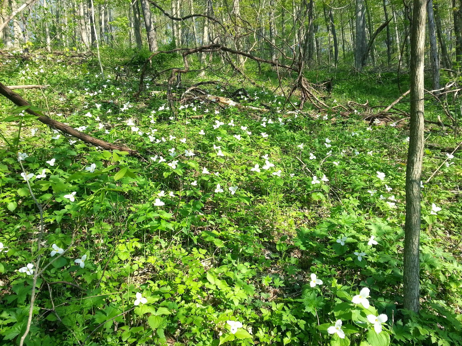
Trillium
We moved along easily and headed up the first of the two climbs of the day.  It really wasn't that bad as my pack was the lightest it was going to get and it was going to be a short day.  
A whole hillside of Trillium
May Apple Flower
We took our last break at Rock Spring Run.  As we were resting we could hear the drumming of a grouse off in the distance.  Spring was definitely down here in the stream valleys.  I didn't fill my water here as I had plenty for the rest of the hike and I wanted to arrive back at the truck as near empty as possible.  Onward up the last climb.

Resting at Rock Spring Run
Bluets 
With just over two miles left, we came to our last view of the hike.  I nice one looking over the Yough valley.  Before too long, we would be down at the level of that river.

Last View
We headed down our last descent and after almost six days of hiking, I finally had a short slip and down I went.  It wasn't bad at all and I blamed it on letting my concentration lapse as we headed down the steep descent.  

Finally, we were at Mile Post 1.  

Thumbs up from KJ.  One mile to go.
I tried my stick pick, phone holder thing again and I need to do some adjustments and test it out more.  It seems hard to get a decently framed picture.  

Stick Pic Photo

The final stairs
The trail comes down from the hillside onto an old gravel road and then heads along the river to the parking lots and this fine establishment, the Falls City Restaurant and Pub.  We were still a little early, but I would be back later.

Mmmmm, beer...
Back at the trucks, I weighed my pack and it has lost about 10 pounds or so.  I estimated that my body had lost about five.  

All done
We went into the changing place for the white water rafters and there was a sign saying the water was turned off.  I tried the sink faucet and out came a slow stream.  That was enough for a quick bandanna bath and a change of clothes made me feel fresh, although I still didn't recommend standing down wind of me.  

We found a little sandwich shop and proceeded to have a very good post hike lunch.  I normally don't take pictures of my food.  (ok, I do from time to time), but when I saw this huge clove of garlic baked into my bread, I had to snap a pic to show my bride.
It was delicious.

Turkey and cheese on a garlic loaf with mac salad as a side
The hike was done.  I felt great.  If there was more trail to hike, I would go hike it, but I had to get back to work.  I really felt like a quick shower and some re-supply and I would be ready to go for another week, or a month, or who knows...

After lunch, we parted ways.  KJ still had some days off left and he was headed to his cabin.  I had to get home and then get back to work at the Museum.  Our busy season was starting.  

Not ready to head home yet, I went back over by the outfitters and walked around their store again.  I say Crash, our shuttle driver and talked to him for a bit.  As we were talking a girl sitting on the bench asked me if my shirt was an ATC shirt.  It was of course and I had a nice conversation with Pheonix, who is from Carlisle and had volunteered at the Mid-Atlantic Regional Office of the ATC in Boiling Springs.  She was now working as a raft guide I think.  These people here seem to really be living the dream.  

After our nice talk, the Pub had opened and I headed over for a celebratory PBR.

This hike was awesome.  I highly recommend it.  It take some planning and you have to stick to your itinerary and pay for the shelters, but it was all worth it.

In a few days, I will try to make another post about the gear I brought, what I used and what I just carried.  Some of that stuff I will still carry as I see it as emergency gear, but other stuff I will probably leave behind.

Thanks for following along.  

EarthTone (Wrong Way Joe)

Day 1 - Day 2 - Day 3 - Day 4 - Day 5 - Day 6

Friday, May 22, 2015

Laurel Highlands Hiking Trail - A Thru Hike (Day 5)

LHHT Day 5
1. Date: 5/7/15
2. Day 5
3. Morning temp: 59. Later 85
4. Weather: Cool, clear, followed by sunny and hot.
5. Time start: 0705
6. Time stop and miles: 1428. 11.4
7. End point: Ohiopyle Shelter
8. Events: owl, bird chase

Log: Up before six and on trail a little after seven. Day grew hot fast, but water was plentiful. The long downhill into the shelter was a killer. Tomorrow we finish.

Another cool morning greeted us as I rolled out of my bag and started the day.  It was clear above and I was on the trail a little after seven.  Today was a "shorter" day of about 12 miles and the start was good.  

As I started out, the trail followed along a small stream for a while where this cool little falls could be heard quite a ways off.  I was making my way up the hill when a really cool thing happened.  A small bird came flying down the trail and passed me at about knee height.  It was really quick, but I could feel it alter its course enough to avoid me and my trekking pole.  Withing a fraction of a second, a second bird came by, hot on the first birds tail.  It all happened in the span on about a half of a second, but it was still pretty cool.  I'm guessing bird #2 was chasing some tail, literally.  

Small falls
Once again, I came upon a fossil stone in the trail. 

Fossil 
I was drinking lots of water again today as we passed some good streams and was drinking my fill and filling up as much as I could.  I always feel better when I'm well hydrated.  It makes everything go easier.  The evening before I had run out of Part A of my Aqua-Mira, but still had plenty of Part B.  I'm not sure how that happened other than maybe not closing the lid a while back and had some leakage, but KJ had two sets and gave me some of his Part A, but today I started using my Sawyer Mini Filter on my Smart Water bottle and it was working pretty good.  The filter is nice as you can drink immediately and don't have to mix chemicals and wait the proper times to mix and drink.  I'm glad I carry both, so I can adjust to the situation at hand and will probably continue to do so.  

Only 15 miles left
Logged area
After passing this sign, we walked past a logged out area.  The heavy machinery was long gone and the logged forest didn't look too bad.  They had left a lot of mature trees and it looked very "park" like as we skirted the edge of the area.  Careful, controlled logging can be a good thing for a forest.

Water and rest stop

After lunch we started our 1400 foot elevation loss.  It was a pretty steep going down, but we just carefully made our down over about three miles.  As we got lower, spring started to pop.  Earlier in the hike, the May apples are just spreading their leaves.  Here, they already had their little fruit.  It was an interesting transformation that elevation change does to the ridges. 
If this isn't fair weather, I don't know what is...
Once again we arrived at the Shelter turn off.  This would be our last night on the trail and our shelter #3 was waiting for us as usual.  We crossed the creek, which was running very well, and climbed up the bank to find our shelter.  We set to doing our usual end of day chores and my food bag was getting pretty empty, just as I had planned it.

For most of my hikes I have had a lot of food left over at the end of the hike, but I had been concentrating on planning my meals better, taking into account my lower appetite when a hikes starts out, but I was starting to get the hunger now.  I ate my last Mountain House meal and it was good.  All I had left was breakfast, some powdered milk and a jelly packet.  Perfect.


Ohiopyle Shelters - #3 Shelter, our home for the night
As I lay on my sleeping pad and looked out into the forest, I noticed how that elevation change had changed the forest.  The trees were more fully leafed out here and everything was much greener.  It was a welcome transformation.

It got green after dropping 1400 feet
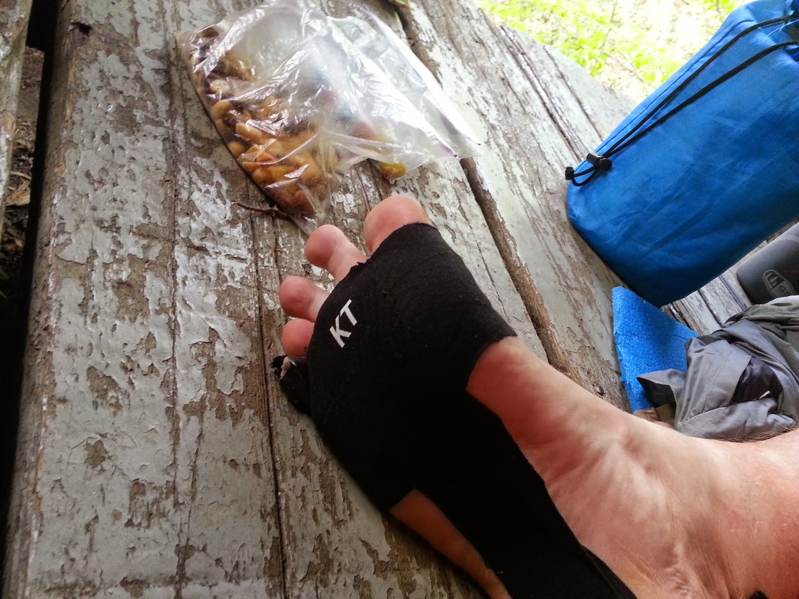
My tapped up feet were still doing fine.  The KT tape was easily lasting three days at a time (which is good, because that shit ain't cheap) and my two little toe blisters had stayed small and weren't causing me any trouble while walking.  The toe socks had helped tremendously and I was glad I had them.  


Tape works

Recommended by KJ
I do carry some "useless" stuff, like this little guy here.  I found him in my back yard and have no idea where he came from as there are no little kids on that side of my house, but he now rides on my pack to greet all who come by.  I'm still trying to figure out where he comes from.  There is a logo on his shoulder that looks like a J and a P.  It is still a mystery to me.

The useless, (but meaningful) shit I carry. 
After a final pleasant fire in the shelter, it was time once again to slumber through the night.  I tried some things with my failing sleeping pad, but none of them worked, but I slept good enough.  
This... is... the... life...
We had only six miles of trail left and would finish on the morn.  This was a very short Thru Hike, but a very cool one also.  I was feeling great, my feet were no longer aching at the end of the day and I felt as if I was already hitting a decent stride.  If there were more miles to hike and more time to hike them, I was up for that, but duty was calling and it would soon be time for me to get back to work.  

Tomorrow we would finish...

Day 1 - Day 2 - Day 3 - Day 4 - Day 5 - Day 6


Tuesday, May 19, 2015

Laurel Highlands Hiking Trail - A Thru Hike (Day 4)

LHHT Day 4
1. Date: 5/6/15
2. Day 4
3. Morning temp: 57. Later 80
4. Weather: cool clear. Later warm
5. Time start: 0730
6. Time stop and miles: 1611. 13.5
7. End point: 653 Shelter
8. Events: Seven Springs
Log: Up at 6 again and out by 0730
Good trail today. Seven Springs the highest point on the trail.


The morning dawned cool and clear again with another possible hot day ahead of us.  I re-taped my feet and today I would wear my Injinji toe socks.  After the day's walk, I would wonder why I didn't start out wearing these amazing socks.  They really helped with my little toe blisters and felt great all day.  I would definitely be buying at least one more pair after this hike.

Today I would be hiking the second two days of my 1982 hike in one day.  I remember back then that I was so glad to be done at Grindle Ridge after a seven mile day.  Today would be almost double that, but the climb out of Blue Hole Creek would still be as "fun" as it was all those years ago.


Temp tattoo is wearing off a little
I was on the trail at 0730 with KJ not too far behind.  Before long he caught up to me and as we crested a hill we could see some cell towers in a clearing.  Right in front of it was a small fire ring.  This was the first impromptu campsite we had seen during our hike.  With the rule being you must sleep at the shelter areas, these are either very rare or very well hidden off trail a ways.  


Unofficial (illegal) campsite
We ventured out into the clearing and over on the next mountain, we could see Seven Springs.  We would be over there looking back in a few miles.  


Seven Springs in the distance. That is snow showing between the towers legs.
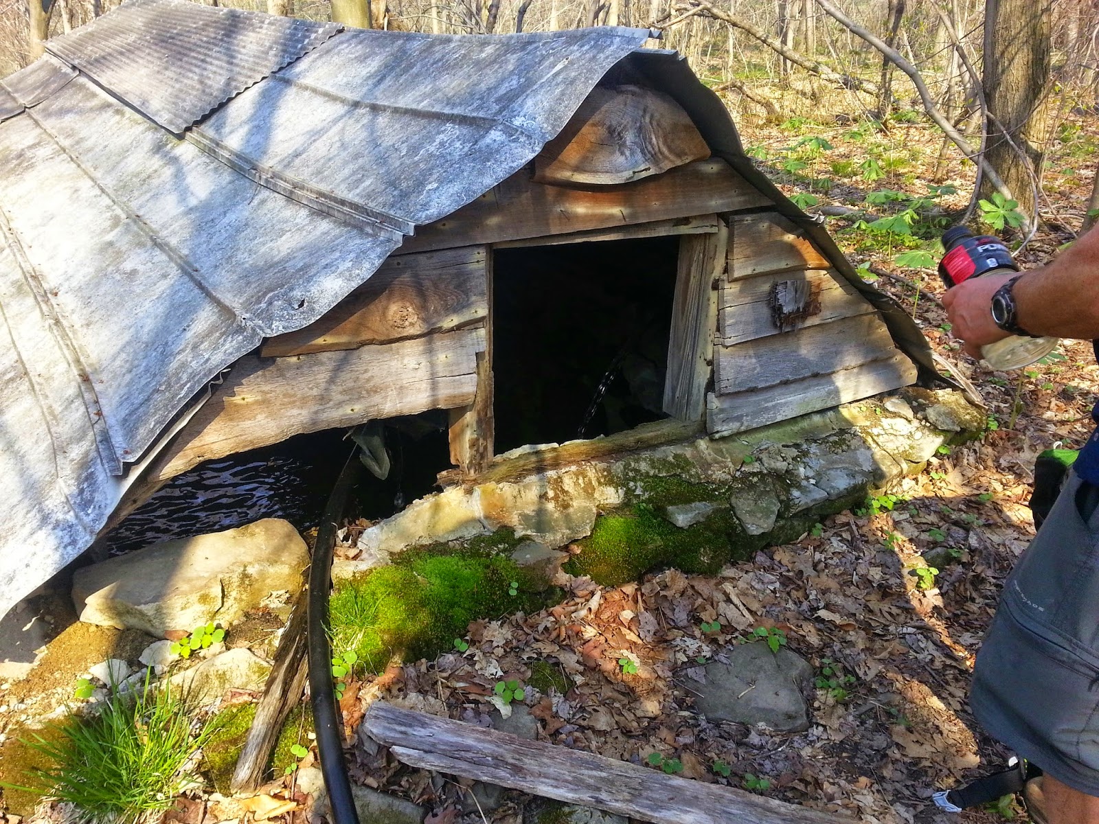
As we headed down the next hill, I could hear water flowing.  It was time to drink up and fill our bottles and we found this awesome spring house just pouring it clear water into the space.  Poking my head in the window, I was tempted to dive into the couple feet of clear cold water, but decided that wasn't the best idea.  Instead, I drank up and filled up and moved on.  
Spring House
As we approached Seven Springs, we came upon these beautiful beasts, just hanging out in their corral.  This was the Seven Springs Stables and the curious horses gave us a glance or two until we hiked on by.  


Seven Spring Stables
Before too long, we were at Seven Springs and walking along it wide open spaces as we followed the trail across the resort.  It was still too early for lunch, so we took a nice break in the shade of some pines at the crest of one of the hills.  It was very pleasant and if we didn't have plenty of miles still to go, it would have been the perfect place for a short nap.  
Seven Springs View
Chillin in the shade
We moved on and kept following the trail through the resort.  This is the highest point of the LHHT.  It was all down hill from here.  I wish...

Looking back at the towers we passed.
That little line sticking up on the horizon in the middle of the picture above is the towers we had walked past a little over an hour ago.  It is really cool to have a view of where you are going and where you have been and this area was perfect for doing that. 


Lake Lodge
The trail continues under the ski lifts and heads to Tahoe Lake.  This lake is a rather recent addition I believe.  It wasn't here in the early 80s and the maps in my old trail guide don't show it, but it is a very nice lake that would be very refreshing on a hot day like this day.  After checking out the closed lake lodge, we hiked on.


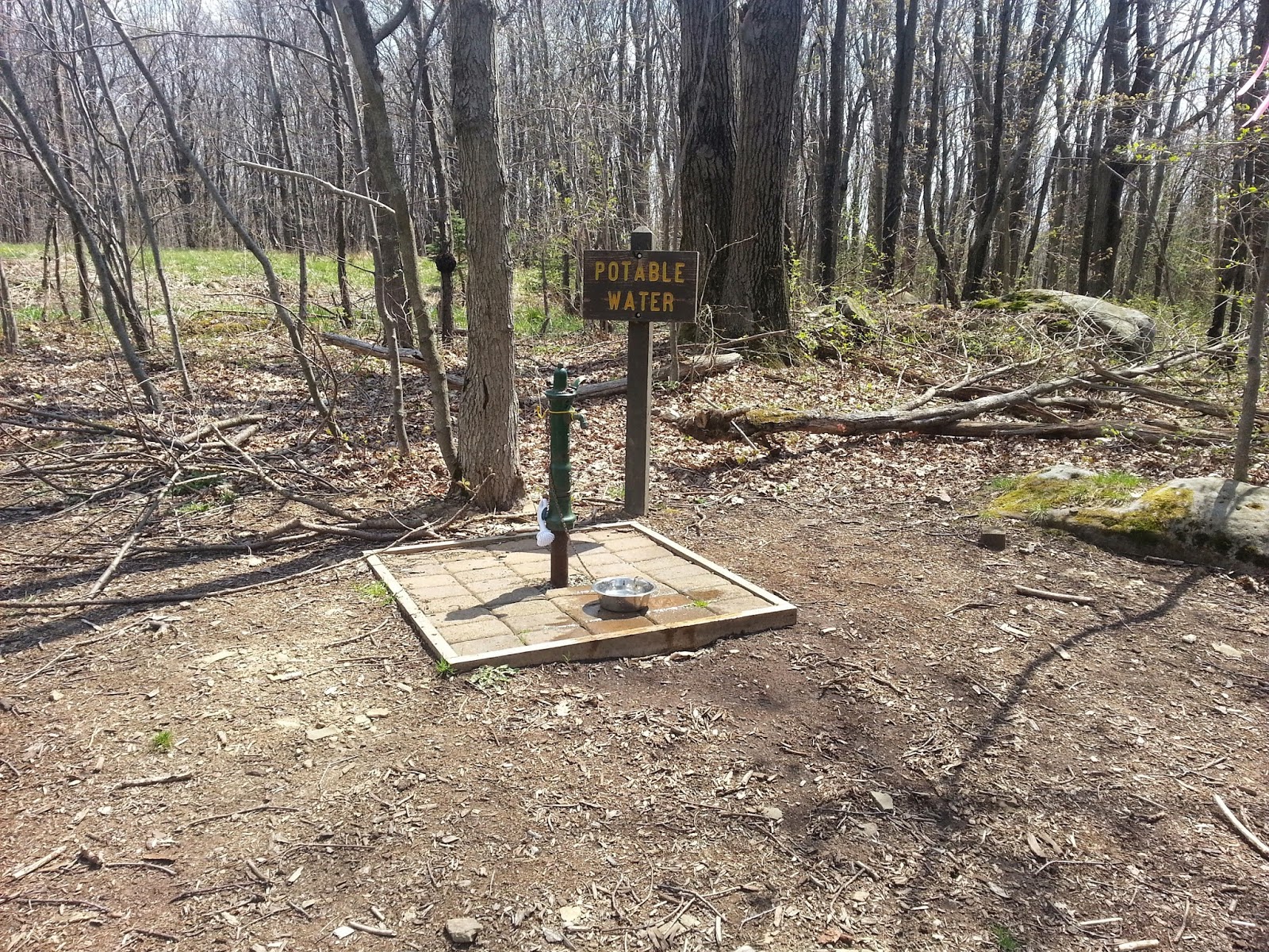
One of the few potable water faucets
We cameled up and cooled down with this nice water faucet that is next to a road on the trail.  It was very refreshing.  It was almost time for lunch.


The climb out of Blue Hole Creek towards Grindle Ridge Shelter area
Right around Noon, we came to Blue Hole Creek, which is a nice flowing creek.  I instantly remembered those stone steps heading up out of the valley and the pain I felt as I had this one more climb until our shelter area for that day long ago in 1982.  Today, it would be just another climb of many.  We ate a nice lunch at the site and filled our water for the next leg of the journey.  We didn't walk into Grindle Ridge Shelter Area today to check the water situation.  There are reports that the water tastes a little funny and we still had miles to go before we slept.  


Another nice and interesting rock maze, what I started calling Squeezers
View looking west.  Notice how the trees are still just starting to bud.
Graveyard near Rt 653
We passed this small graveyard shortly before crossing Rt 653.  It is an old cemetery with some of the head stones having some very old dates and other just field stone propped up as a head stone.  

At around four pm, we headed to the Rt 653 parking lot where we hoped to get some more potable water before heading down to the shelter area.  This water probably was drinkable, but it came out orange and there was literally a spoonful of rust that would gather at the bottom.

Our shelter was the first one you came to on the blue blaze into the shelter area and this one had a nice little wall as it was propped up on the hillside.  Any night time wandering would be a careful event.  

Shelter #3 and #4 
After checking the pump, we dumped our orange soda and filled up with some better looking water.  The creek was running nice here and KJ took advantage of that down stream to clean up a little.  

Rest rooms and pump area - Rt 653 Shelter Area
After dinner, when I was relaxing in the shelter as had become my MO, we heard some rain start.  It started and ended very quickly, maybe about 10 minutes of rain.  With the heat of the day, it would have been refreshing, but I was comfortable where I was and already dozing.  

Soon it was sleep time.  During the night, we would hear an owl asking us all "who cooks for you?"  It was cool.  

Only two more days left.  


Day 1 - Day 2 - Day 3 - Day 4 - Day 5 - Day 6