"A good battle plan that you act on today can be better than a perfect one tomorrow."
General George PattonWe needed a new plan and I immediately started creating one. With my sense of helplessness, being so far away from my other mode of transportation besides feet, I (we) wanted to get closer to the truck to gain some control back.
As we were $huttled back to the truck, I started making some other plans for the next few days. We would do some yellow blazing (traveling along the trail by vehicle) and maybe check out some of the "high points" of the trail, giving Lisa's ankle some rest and taking it one day at a time with much more control of our doings and goings.
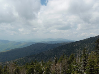
When we got back to the truck, I suggested driving to Clingmans Dome up in the Smokies, which is the highest point the AT passes. It straddles the North Carolina and Tennessee and borders and has a nice visitor's tower to climb. We got there and found a parking place quickly. The day was pleasant, with some clouds. It was pretty warm. It was weird up there at 6643' of altitude. It looked like spring had just arrived.
 |
| View from Clingmans Dome parking lot |
We walked up and went up into the tower for a look around and to take a picture or two. There were quite a few tourists around and a few hikers too. The walk up hadn't been too hard, but it was a little workout. Lisa's ankle felt fine.
 |
| From atop the observation tower |
Next it was another drive to Daleville, VA where we got a room at the local Howard Johnsons. It was pretty cheap and there were a lot of hikers there. We settled in and checked our gear. We were in the area of the most photographed location on the trail, McAfee Knob.
Tomorrow we would hike...
No comments:
Post a Comment